The Route Planner for Riders

Plan routes, discover mountain passes and scenic roads, and share your experiences with the community.

Key Features

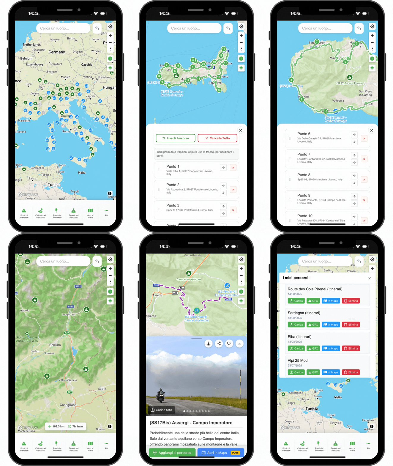
Create your route

Create your route, you choose the road

Add stops on the map and get detailed routes with up to 50 waypoints in a few clicks, exactly the way you imagine them.

To edit them just drag the points on the map: distance, duration and elevation profile update right away.

  • Up to 50 waypoints
  • Advanced planning
  • Add intermediate stops
  • Set any point as the start
  • Reverse route
POI Database

Discover new Passes and Must-Ride Roads

Thousands of Mountain Passes and Scenic Roads to ride, reported by the community.

  • Visible directly on the map
  • Photos, ratings and comments from the community
  • Street View previews
Detailed Maps

Detailed Maps

Choose between street, outdoor and satellite views, with modern and always up-to-date maps. The 3D view shows the terrain relief.

  • Street, outdoor and satellite
  • 3D terrain view
  • Modern, always up-to-date maps
Export, navigate or share

Export, navigate or share

Export your routes as GPX or KML to navigate them with the device you prefer. Follow them in the MotoPlanner App or open them directly in Google Maps.

Share your routes with friends or publish itineraries for the entire MotoPlanner Community.

  • GPX or KML format
  • Navigate in the MotoPlanner App
  • Open in Google Maps
  • Share with friends and the community

The Riders Community

Moto Planner is more than just a planner: it's a hub for motorcycling enthusiasts who want to discover new routes and contribute to mapping the most beautiful roads to ride.

Report Scenic Roads

Report Scenic Roads

Help map the most beautiful roads for riders.

+300 cataloged roads
Explore New Routes

Explore New Routes

Discover the best scenic roads and the passes of the Alps, Apennines, and Pyrenees.

+800 mountain passes
Share Your Photos

Share Your Photos

Upload your photos of points of interest and the roads you ride.

+1000 photos shared
Comment and Share

Comment and Share

Leave comments and suggestions on the roads you've ridden. Every contribution helps improve the experience for all riders.

Popular Points of Interest

Discover the most loved roads and passes by the riders community.

Loading popular POIs...

No popular POIs found.

Popular POIs will appear here when admins mark some as "popular" and they have at least one image.

The MotoPlanner App

Available for Android.

Get the App
Available on Google Play — Android
iPhone Coming soon In the meantime available as a web app.
Your web subscription is valid in the app as well: sign in with the same credentials.
Moto Planner Route Planner Mobile Mockup
Or use it as a web app (iOS or no install)
iOS — Add to Home Screen
  1. Open the browser on your iOS device.
  2. Go to www.motoplanner.com/en/planner.
  3. Tap the Share button at the bottom of the screen.
  4. Scroll down and tap Add to Home Screen.
  5. Optional: rename the shortcut, then tap Add.

The page will appear as an icon on your home screen, like an app.

Android — Add to Home Screen
  1. Open the Chrome browser on your Android device.
  2. Go to www.motoplanner.com/en/planner.
  3. Tap the menu button at the top right of the browser.
  4. Tap Add to Home Screen from the dropdown menu.
  5. Optional: enter a name for the shortcut, then tap Add.

The page will appear as an icon on your home screen, like an app.

App-only

Additional features

Route recording

Real-time route recording via GPS with export to GPX format.

Saved routes sync PLUS

Access to your saved routes, synced directly within the app.

Offline maps, POIs & routes PLUS

Download of maps, POIs and routes for offline consultation.

Access all Features

Features

Free

PLUS

Waypoints per route
10
50
Route saving PLUS
✗
✓
Convert GPX to routes PLUS
✗
✓
Save uploaded GPX PLUS
✗
✓
Favorite POI List PLUS
✗
✓
Save Personal POI PLUS
✗
✓
Outdoor and Satellite Maps PLUS
✗
✓
Public Profile PLUS
✗
✓
Advanced route planning
✓
✓
Access to Mountain Passes and Scenic Roads database
✓
✓
Open routes in Google Maps
✓
✓
Route sharing
✓
✓
Publish roads, routes, photos and suggestions
✓
✓
Download GPX
✓
✓
Upload GPX
✓
✓

Frequently Asked Questions

The Route Planner supports three main export formats: GPX Track (detailed, point by point), GPX Route (main waypoints only), and ITN format for TomTom devices.
- GPX Track: A detailed route made of many points, ideal to follow a path without recalculations (useful off-road and for precisely planned routes).
- GPX Route: A route defined by main waypoints; your device/app recalculates between points, offering turn-by-turn directions and automatic recalculation.
The Route Planner needs an internet connection for initial planning, but you can export routes and save them as GPX for offline use on your navigator or smartphone.
You can share routes by generating a direct link that others can open in the Route Planner and partially edit.
You can add up to 50 waypoints per route. This ensures optimal performance and compatibility with most navigation devices.
Yes, the database of mountain passes and popular roads is regularly expanded and updated with new information.
MotoPlanner uses professional technologies and services to deliver detailed maps, reliable routing, and a smooth experience on web and mobile.

These services have ongoing costs (servers, map licenses, maintenance, and development). The PLUS plan is a small annual contribution that:
• unlocks all planner features,
• supports the project and its growth,
• keeps the site fast and ad-free.

Thanks to your support we can keep improving MotoPlanner for the whole community.
No, you can use Moto Planner's basic version without registration. You'll have access to route planning, the database of passes and scenic roads, and you can export routes in GPX format. Registration is only needed for PLUS features.
You can contribute by uploading photos from your trips and reporting new scenic roads. Every contribution helps improve the experience for all riders.

Ready to Start Your Next Adventure?

Join riders who already discovered the simplest way to plan their trips.

Plan a Route