
Col de Tende — Pass for Motorcyclists
Motorcycle Route Photos: Col de Tende
Map – Col de Tende Motorcycle Route
Description
Col de Tende – Pass Motorcycle Route Description
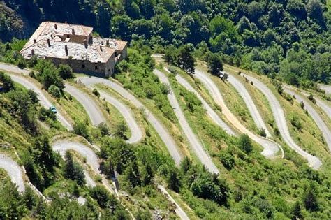
Il Colle di Tenda (Col de Tende) è un valico alpino che collega l'Italia e la Francia, situato a un'altitudine di 1.870 metri. È noto per le sue strade tortuose e panoramiche. L'area è caratterizzata da fortificazioni storiche e offre viste spettacolari sulle Alpi Marittime.
Other Passes & Roads nearby
Loading nearby POIs...
No nearby POIs found.
Plan Your Motorcycle Route with MotoPlanner

Build your perfect motorcycle trip with the best route planner for riders. Discover mountain passes, scenic roads and export GPX files.
- Advanced motorcycle route & itinerary planning
- Database of mountain passes & scenic roads for motorcyclists
- GPX export, motorcycle roadbook & much more
Comments
Leave a review for this motorcycle route